Package GeoSciML/GeoSciML-Core/GeologicFeature
The GeoSciML GeologicFeature package contains the root Feature classes MappedFeature and GeologicFeature.
GeologicFeature represents a conceptual feature that is hypothesized to exist coherently in the world. Specializated geologic features are contained in other packages.
Class Summary |
|
| <<FeatureType>> Classes | |
GeologicFeature
<<FeatureType>>
|
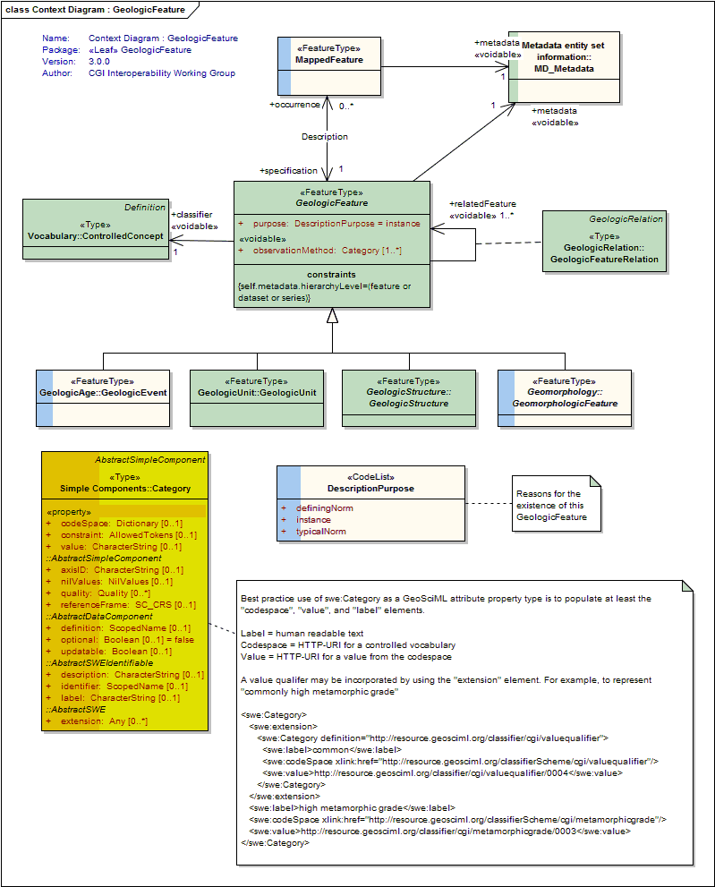
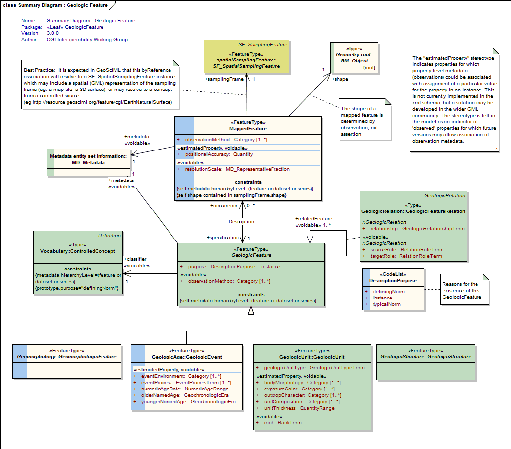
The abstract GeologicFeature class represents a conceptual feature that is hypothesized to exist coherently in the world. * this corresponds with a "legend item" from a traditional geologic map * while the bounding coordinates of a Geologic Feature may be described, its shape is not. The implemented Geologic Feature instance acts as the "description package" * the description package is classified according to its purpose as an Instance, TypicalNorm, or DefiningNorm. |
MappedFeature
<<FeatureType>>
|
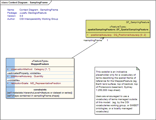
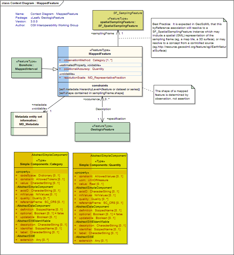
A MappedFeature is part of a geological interpretation. It provides a link between a notional feature (description package) and one spatial representation of it, or part of it. (Exposures, Surface Traces and Intercepts, etc) * the specific bounded occurrence, such as an outcrop or map polygon * the Mapped Feature carries a geometry or shape - the association with a Geologic Feature (legend item) provides specification of all the other descriptors - the association with a Sampling Feature provides the context and dimensionality A Mapped Feature is always associated with some sampling feature - e.g. a mapping surface, a section, a Borehole (see BoreHolesAndObservation) etc. As noted on the diagram, if the associated sampling feature is a Borehole, then the shape associated with the MappedFeature will usually be either a point or an interval. This reconciles the 2-D ("map", section) and 1-D (borehole, traverse) viewpoints in a common abstraction. |
| <<CodeList>> Classes | |
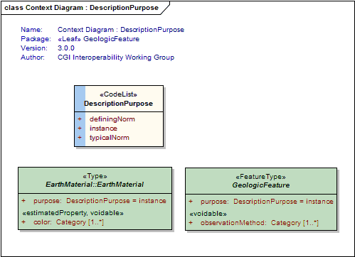
DescriptionPurpose
<<CodeList>>
|
Codes used for the specification of the intended purpose/level of abstraction for a given feature or object instance, ie the reason for the existence of the GeologicFeature. Values: instance, typicalNorm, definingNorm. |
Tagged Values |
||
| Tag | Value | Notes |
| xsdDocument | geologicFeature.xsd | Description: Name of an XML Schema document to create representing the content of this package |
| xsdEncodingRule | iso19136_2007 | Values: iso19136_2007 | iso19139_2007 | iso19136_2007_INSPIRE_Extensions Default: iso19136_2007 Description: XML Schema encoding rule to apply |
UML Diagram: Context Diagram : DescriptionPurpose
UML Diagram: Context Diagram : GeologicFeature
UML Diagram: Summary Diagram : Geologic Feature
UML Diagram: Context Diagram : MappedFeature
UML Diagram: Context Diagram : SamplingFrame